
Zoom In
Open Google Maps, switch to satellite, and go to Rafah. As of this weekend you can. Google quietly replaced its Gaza tiles with imagery from as recently as June 2026, and the internet spent Sunday panning across it.
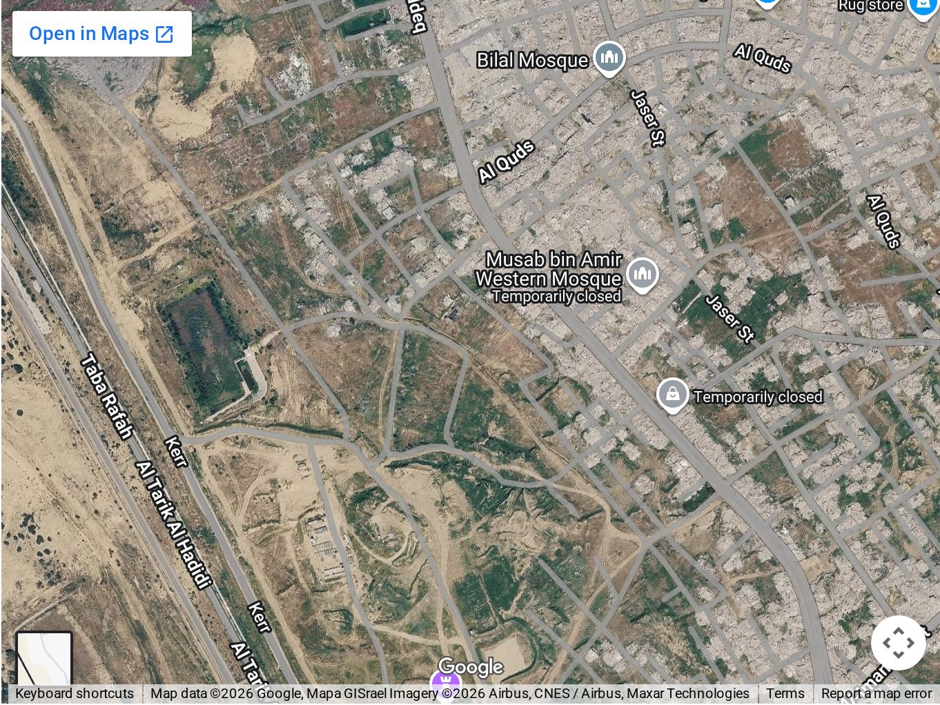
That took a while. From 1997 to 2020, US law capped commercial satellite imagery of Israel and the Palestinian territories at two meters per pixel. Gaza was a blur on every map app through three wars while Seattle was sharp enough to count cars. The cap lifted, the sharpness arrived, and this is what it shows. (NOAA on the 1997 limit; 2020 notice lifting it)
The UN’s satellite unit puts the damage at 82% of all structures in the Strip, just over 200,000 buildings, and counts 134,422 of them destroyed outright, more than half of everything that stood before the war. From a drone it stops being a percentage. (UNOSAT; UN News, Aug 13, 2026)

I wanted to know whether the worst-hit cities of the Second World War looked like this. They did.
| People | Share destroyed | How long | |
|---|---|---|---|
| Warsaw, 1939–45 | 1.3M | 85–90% | six years; nearly half of it demolished after the fighting stopped |
| Hamburg, 1943 | 1.7M | 75% | one week |
| Cologne, 1940–45 | 0.8M | 61% | five years; 262 raids |
| Dresden, 1945 | 0.6M | 59% | two nights |
| Berlin, 1940–45 | 4.3M | 33% | five years; 314 raids, then the ground battle |
| Gaza Strip, 2023–26 | 2.1M | 82% damaged, over half destroyed | three years, still rising |
Hamburg had about 1.7M people in 1939. Gaza had 2.1M in 2023, more people in half the space. Operation Gomorrah ran eight days and seven nights in July 1943 and killed somewhere between 34,000 and 40,000; a million people left the city that week. Gaza’s three years have killed 74,000 by the Gaza health ministry’s count, the only running tally there is; the UN uses it, and Israel has never published its own. 1.9M people are displaced. Hamburg’s happened in a week. Gaza’s has run three years, and more than 1,100 people have been killed here since the October 2025 ceasefire. (Hamburg; Gaza · Ground Truth)


The number of destroyed buildings kept climbing after the guns stopped too. The UN says destroyed structures rose 9% after the October 2025 ceasefire, and Al Jazeera’s satellite unit found demolitions in Shujayea, Tuffah and Rafah through mid-December 2025, inside the 58% of the Strip Israel holds behind the yellow line. The IDF says those demolitions fall within the ceasefire and answer active threats, mostly tunnels under buildings and risks to its troops. There’s a Gaza tab at the top of this site, updated daily, and in 213 of these notes I’ve never written about it. The map doesn’t need me to. (UN News; Al Jazeera Sanad, Dec 15, 2025)
The UN Development Programme ran the rubble clearance after the 2009, 2014 and 2021 wars: 2.8M tonnes, all three combined. This war has left 61M tonnes. The agency’s best case for clearing most of it is seven years, and in August 2026 the UN said its partners still lacked the permissions and equipment to remove the unexploded ordnance inside it. (UNDP; UN News, Aug 13, 2026)
More footage

